While Texas through North Carolina will be 15 degrees above average, the upper Midwest will be 10 degrees below normal.
It is hard to believe that just a week ago temperatures were almost 20 degrees warmer than our expected highs for today. Our start of October that had five 80 degree days will soon be a distant memory as colder air starts to filter into the area.

For today, highs will only reach near 60 degrees. With this deep low pressure system located to our north, strong west to northwest flow will continue across our area today.
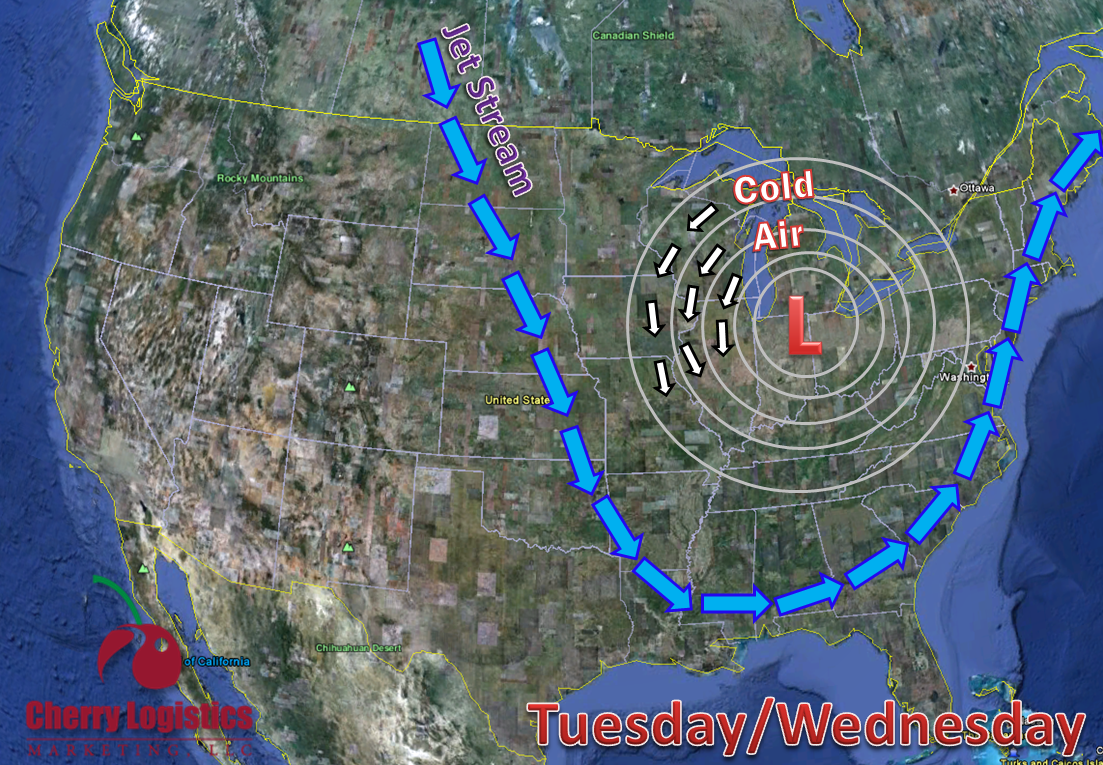
As we make our way into tomorrow and Wednesday, a longwave trough will start to dig into our area and it will give us our next chances for precipitation. After this system moves in, it will set up a northerly flow giving us shots of much cooler air. This northerly flow will increase chances for lake effect showers for far northeastern Illinois and northwest Indiana. High temperatures over the next several days will only reach the lower 50s and our lows only into the upper 30s.
~Meteorologist Heather Brinkmann
No comments:
Post a Comment