WFFA.com
With the numerous tornadoes that traveled through populated areas last year, it is hard to think that it would not have happened again this year. Unfortunately, tornadoes were targeted near the Dallas area today.
The video above was recorded by a local television station's helicopter. It is showing a tornado south of Dallas ripping apart tractor trailers. It is uncertain, at this time, if anyone was hurt from this storm or the other tornadoes that formed near Dallas.
As a meteorologist, I like to diagnosis the atmospheric setup to figure out how these tornadoes formed. So this is what I found:
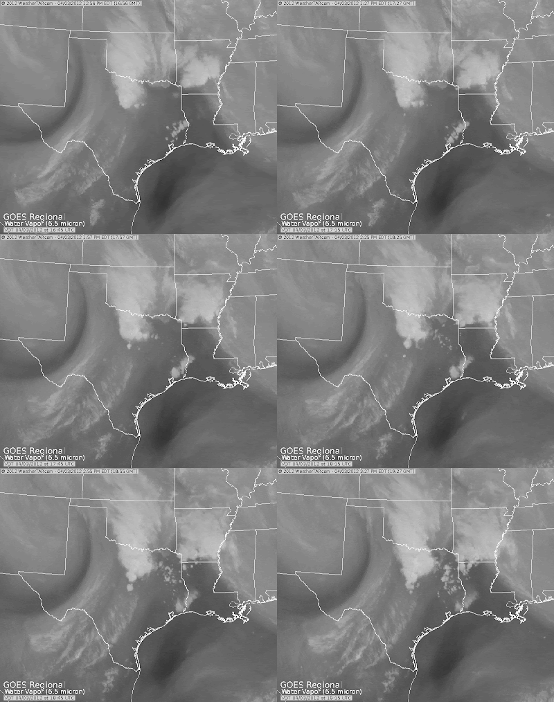
A strong upper level low pressure system is currently positioned in northeast New Mexico. While this system helped to form storms in Texas, it is also providing upwards of a foot of snow to Colorado. You can see as it tries to move eastward in this water vapor imagery loop.
As it makes its way eastward, it is producing storms to the Texarkana area (Texas, Arkansas, and Louisiana). This upper level low is actually being steered by the oncoming system that is moving into the Pacific Northwest. This can be seen in the image below.
Not only does this upper level system play a big factor in producing these storms, but so did the storms that moved through last night. After the storms moved from northwest Texas yesterday, they left behind a moist boundary layer. Also, sufficient outflow boundaries were left from the storms. Moving on to today, clouds were able to break enough this morning so that the sun could heat up and destabilize the atmosphere. Modest CAPE(Convective Available Potential Energy) of upwards of 3000 J/Kg was in place by early afternoon. And to add to all of the other severe weather ingredients in place, a trailing cold front moved through Texas initiating storms ahead of it. Combining the preexisting outflow boundaries and the trailing cold front, wind shear(change of wind speed or direction with height) was able to increase the already sufficient low level shear in place.
More than enough severe weather ingredients were in place today to form these storms. However, it is unfortunate that these tornadoes went through such populated areas.
~Meteorologist Heather Brinkmann


No comments:
Post a Comment