Tuesday, April 17, 2012

135 Tornado Reports But Only Few Deaths?

135 tornado reports were logged by the Storm Prediction Center on Saturday and early Sunday morning. Nearly 100 of these tornadoes were seen in Kansas. This amount is more than the standard for an entire month's total.

With 135 tornado reports, one would think many human casualties must have come from this many storms. On the contrary, only five people have been pronounced dead thus far from the outbreak. While that still is five misfortunes, the tally could have been much greater. Tornadoes ripped through populated areas like downtown Wichita, Kansas and severed 75% of the town of Thurman, Iowa, but both recorded zero deaths. How? Enough notice.

Meteorologists are dogged for missing forecasts and supposedly being wrong half the time, but does missing the amount of cloud cover or exact temperature really impact people? Are peoples' lives really at stake? The weather models were hinting at severe storms almost a week and a half in advance and continued that pattern until that Saturday. The Storm Prediction Center put out a severe weather outlook an entire week in advance.


Every day until that outbreak, they mentioned what the models were showing and at three days out, they warned of the intense severity. By consistently saying that severe storms would break out in the Kansas and Oklahoma area a week in advance from a very well respected group of meteorologists, people got the picture. Action plans were put in place days ahead. Evacuation arrangements were made in case these dreaded tornadoes hit close. Warnings were made and people listened.


Meteorologists saved lives that Saturday.


~Meteorologist Heather Brinkmann

Tuesday, April 3, 2012

Tornadoes in Dallas


WFFA.com

With the numerous tornadoes that traveled through populated areas last year, it is hard to think that it would not have happened again this year. Unfortunately, tornadoes were targeted near the Dallas area today.

The video above was recorded by a local television station's helicopter. It is showing a tornado south of Dallas ripping apart tractor trailers. It is uncertain, at this time, if anyone was hurt from this storm or the other tornadoes that formed near Dallas.

As a meteorologist, I like to diagnosis the atmospheric setup to figure out how these tornadoes formed. So this is what I found:

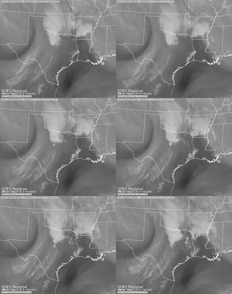
A strong upper level low pressure system is currently positioned in northeast New Mexico. While this system helped to form storms in Texas, it is also providing upwards of a foot of snow to Colorado. You can see as it tries to move eastward in this water vapor imagery loop.


As it makes its way eastward, it is producing storms to the Texarkana area (Texas, Arkansas, and Louisiana). This upper level low is actually being steered by the oncoming system that is moving into the Pacific Northwest. This can be seen in the image below.


Not only does this upper level system play a big factor in producing these storms, but so did the storms that moved through last night. After the storms moved from northwest Texas yesterday, they left behind a moist boundary layer. Also, sufficient outflow boundaries were left from the storms. Moving on to today, clouds were able to break enough this morning so that the sun could heat up and destabilize the atmosphere. Modest CAPE(Convective Available Potential Energy) of upwards of 3000 J/Kg was in place by early afternoon. And to add to all of the other severe weather ingredients in place, a trailing cold front moved through Texas initiating storms ahead of it. Combining the preexisting outflow boundaries and the trailing cold front, wind shear(change of wind speed or direction with height) was able to increase the already sufficient low level shear in place.


More than enough severe weather ingredients were in place today to form these storms. However, it is unfortunate that these tornadoes went through such populated areas.


~Meteorologist Heather Brinkmann